CUHK
News Centre
CUHK Develops Real-time Air Quality Mobile ApplicationReceives the Hong Kong ICT Awards 2018
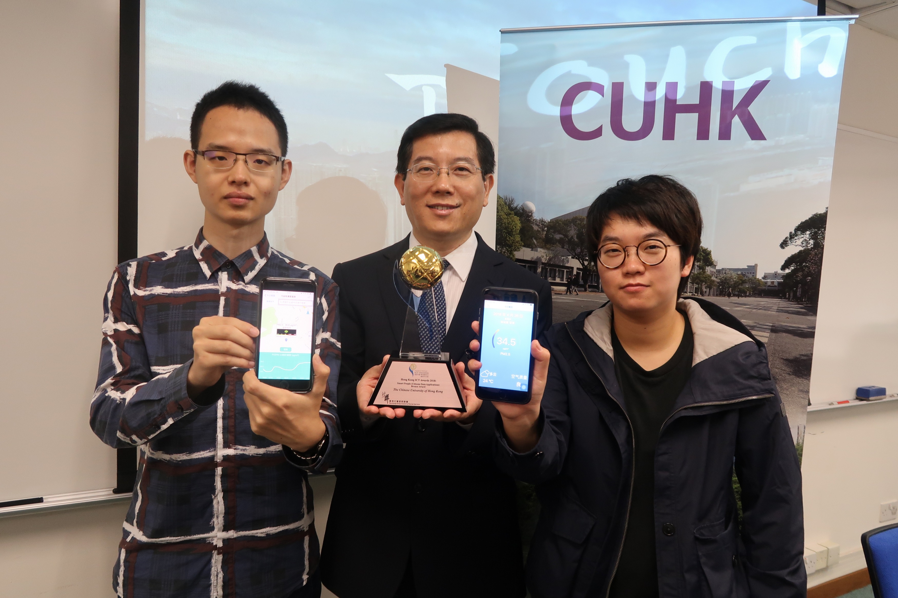
A mobile application called Touchair, developed by a research team led by Prof. Huang Bo, Professor of the Department of Geography and Resource Management and Associate Director of the Institute of Space and Earth Information Science (ISEIS) at The Chinese University of Hong Kong (CUHK), could allow the general public to access real time air pollutant concentrations at any location in Hong Kong and Mainland China. The application has just won the Hong Kong ICT Award 2018 – Smart People (Citizens Data Applications) Bronze Award.
Based on a sophisticated artificial intelligence (A.I.) model, Touchair could provide highly accurate air pollutant data without being limited by finite monitoring stations, and could facilitate “smart mobility” in the city as users can plan their everyday trips according to the data and reduce exposure to highly polluted air.
Provides real-time air pollutants data at any location
Air pollution, which has a serious toxicological impact on the human respiratory system, is a major and growing concern in Hong Kong and Mainland China, and thus there is an increasing demand for access to more accurate and timely air pollution data so as to reduce exposure to unhealthy air. However, the number of monitoring stations and their coverage are limited. For example, there are only 16 general and roadside stations covering the city’s 1,100 square kilometers of land on an hourly basis. The sparse distribution renders them insufficient to capture the large spatial variation of urban air quality.
Touchair incorporates a sophisticated spatio-temporal statistical model developed by Prof. Huang’s research team, which is able to estimate six principle air pollutant concentrations (PM2.5, PM10, NO2, O3, SO2 and CO) in real-time and at any location, given the data trawled from the sparsely distributed environmental monitoring stations. The spatio-temporal statistical model also makes use of satellite imagery with areal coverage, aerosol network (AERONET) data, traffic conditions and meteorological data all trawled from the internet to improve the estimation accuracy up to 80%. Apart from showing real time data, Touchair could also predict air quality in the next 24 hours and record users’ daily exposure to fine suspended particles, PM2.5. These functions help citizens reduce exposure to air pollution in their daily living and traveling and thus make informed choices towards a healthy lifestyle. Touchair is now on Android and iOS phone.
Helps promote the development of Smart City
The government is striving to build Hong Kong into a smart city and one of the major initiatives is introducing smart lampposts. These devices are equipped with numerous sensors, not only for lighting but also to provide up-to-date transportation, regional meteorological and air quality information. Prof. Huang remarked, “Touchair’s algorithm could be implemented in smart lampposts to provide higher spatial and temporal resolution and accuracy, thereby offering better services to citizens. Touchair is still under further development and more functions are being added to it. One primary function will be indoor air quality monitoring. We hope this tool can contribute to Hong Kong’s smart city development.”
About Prof. Huang Bo
Prof. Huang Bo’s research interests span across remote sensing image fusion, spatio-temporal big data analysis, environmental monitoring, and sustainable space planning. He and his team have developed a unified remote sensing image fusion technology that generates synthetic imagery with simultaneously high spatial, temporal, spectral, and angular (STSA) resolution to capture complex structures and changes in a dynamic, high-density urban environment. It is the first time in the world that such a technology has been proposed and developed, and it represents a breakthrough in earth observation from space, contributing to more advanced applications in environmental and ecosystem monitoring. This research brought him the Best Paper Award in the 19th International Conference on Geoscience and Remote Sensing. Prof. Huang is Chang Jiang Scholar (Chair Professor), Ministry of Education of People’s Republic of China and Asia-Pacific Editor of the world-renowned journal – International Journal of Geographical Information Science (Taylor & Francis).
About The Chinese University of Hong Kong
Founded in 1963, CUHK is a leading comprehensive research university with a global reputation. Located in the heart of Asia, CUHK has a vision and a mission to combine tradition with modernity, and to bring together China and the West. Under the University’s unique collegial system, the programmes and activities offered by its nine colleges complement the formal curricula by delivering whole-person education and pastoral care. The University has eight faculties: Arts, Business Administration, Education, Engineering, Law, Medicine, Science, and Social Science. Together with the Graduate School, the University offers over 300 undergraduate and postgraduate programmes. All faculties are actively engaged in research in a wide range of disciplines, with an array of research institutes and research centres specialising in interdisciplinary research of the highest quality.
CUHK is recognised as the most innovative university in Hong Kong and ranks 27th in the Asia-Pacific region in the latest ‘Reuters: Asia Pacific’s Most Innovative Universities’ listing. The University currently has more than 800 granted patents in different jurisdictions worldwide. A majority of these patents have been licensed to relevant industries that help bring these innovations to the market to benefit society. In academic year 2016-17, CUHK has received 88 granted patents and filed 183 patent applications for inventions developed in the areas of medical technology, biotechnology, information technology, telecommunications, and materials science.
The "TouchAir" mobile app, developed by Prof. Huang Bo (middle) and his research assistant Tong Xuelian (right) and Sun Peifeng (left), has awarded the ICT award 2018.


